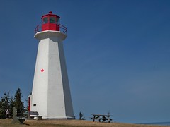
 If you were on a boat near Cape George, Nova Scotia in the mid 1800's, you couldn't help but notice the lighthouse. And, if you did, you'd be in a bit of trouble!
In 1861, the first of three lighthouses were built to guide fishing boats around Cape George Point. This first lighthouse was powered with a ten foot diameter iron lantern, with eight sides and cut glass prisms that demanded 120 gallons of oil each year. Glass prisms from the second lighthouse where unique and rare in cut and are on display at the Bluefin Tuna Interpretation Centre, a few minutes down the road at Ballantyne's Cove wharf.
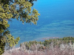 Over 107 years there were four lightkeepers. From the Condon family (1861) to Alex MacEachern (whose annual salary was $450), Charles Falkenham and finally William Clark (1968), they kept the lighthouse lit 24/7. Today, the lighthouse is automated and unmanned. The grounds are kept well by volunteers and there are a lot of picnic tables to eat your lunch, enjoy the view and snap pictures of St. George's Bay, PEI and Cape Breton. Interpretive panels are on site to learn more about the history of the area.
To get there, take route 337 which follows the shoreline through small fishing communities overlooking the Northumberland Strait. It's a beautiful drive.
Area information:
Arisaig: Part of the Mini Cabot Trail
Cape George Lighthouse
The Cape George Hiking Trail offers 33 kilometers of connected loops and linear sections.
Cape to Cape Trail Nova Scotia’s first long distance footpath traveling over 400 kilometers, all the way from Cape Chignecto in Cumberland County to Cape George in Antigonish County. It's under construction.

 On a warm spring day, my sister and I took a mini road trip to the "Mini Cabot Trail". Wouldn't it be cool if we were driving a mini?
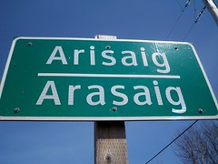
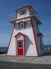 In Arisaig, signs direct you to a lighthouse at the end of a point. At the lighthouse, interpretive signs circle its base that tell stories of the area. Like the 17th century story of "Frenchman's Barn" - when the crew of a French sailing ship thought a massive rock not far from shore was a building and ran aground.
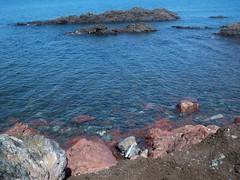 The 4 kilometres of coastline from McArras Brook to Arisaig Point, including