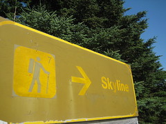
 Ever see a TV commercial or magazine ad of Cape Breton and wonder, "where is that place?" Well, I found the place. It's called the Skyline trail.
The trail is #7 on Parks Canada's Cape Breton Highlands visitor map and judging by the packed parking lot at the trail entrance, this 9.2 km (5.7 mi) trail is a popular one.
 Since it was 26C, we packed a lot of water for the hike. We stopped for a quick break to see a presentation on moose delivered by two Parks Canada interpreters. This info was helpful because we did encounter a moose on the trail, busy eating grass while hikers quietly watched and kept their distance. While driving up MacKenzie Mountain that morning, we also encountered a moose who was oblivious to the dozens of people with cameras.
As we were hiking along the relatively flat trail, once in awhile you'd get a blast of refreshing ocean air. You could listen to the vehicles climbing or descending nearby French Mountain (455 m).
 Once we reached the end, the landscape opened up and we were rewarded to a breathtaking panoramic view of the Atlantic Ocean. The trail led to wooden stairs - we counted 278 steps to the lower observation platform. As we soaked in the view and were cooled by the ocean breeze, we took a lot of pictures and picked wild blueberries that were growing just a short arms-length away from the platform.
Unfortunately it was time to go and hike back to the car. Although the trail map said that hike was 2 - 3 hours round-trip, we hiked it in 1 1/2 hours.
Helpful links:
Link to all the trails in the Cape Breton Highlands National Park of Canada.
Skyline Trail description

No comments:
Post a Comment